


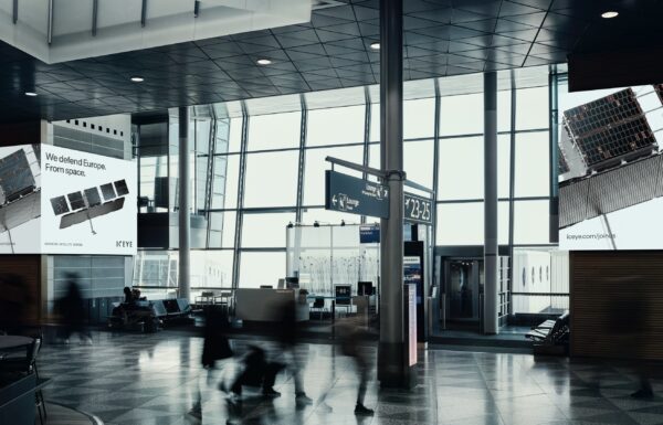


On Wednesday, June 26, 2024, the Main Intelligence Directorate of the Ministry of Defense of Ukraine (HUR MO) summarized the ongoing cooperation with the Polish-Finnish company ICEYE, which has been providing imagery from reconnaissance microsatellites equipped with Synthetic Aperture Radar (SAR) for defensive warfare against Russia since August 18, 2022.
 The Crimean Bridge / Photo: HUR MO via ICEYE
Thanks to fundraisers organized by the Serhiy Prytula Charity Foundation and blogger Ihor Lachenkov, as well as donations from Ukrainian citizens, radar imaging services were purchased for the Ministry of Defense of Ukraine to support military operations from space following the outbreak of full-scale war with the Russian Federation.
As emphasized by HUR MO, images are obtained not only of temporarily occupied territories of Ukraine but also of Russian territories where Moscow deploys its military units.
In total, 4,173 images of Russian objects have been obtained so far, including:
- 370 – airstrips;
- 238 – air defense and radar positions
- 153 – storage facilities for oil and other fuels;
- 147 – storage facilities for missiles, aircraft and ammunition;
- 17 – naval bases.
 Naval base in Novorossiysk
ICEYE satellites also capture images of fixed deployment points of Russian forces, Central Tank Reserve Bases, and other storage sites for heavy military equipment, military towns, and military recruitment offices (mobilization centers). This allows tracking the dynamics of Russian movements related to equipment and military personnel, revealing invaders’ intentions so they can be disrupted.
Finally, the satellites allow monitoring of objects within the Russian military-industrial complex and its logistical infrastructure, including the illegal Crimean (Kerch) Bridge between Russia and the occupied Crimea.
 Sevastopol Bay
A huge advantage of synthetic aperture radar imaging satellites is their ability to clearly locate and identify concentrations of Russian forces and assets, even those carefully hidden using camouflage measures in the field. The photographs can precisely identify the types of detected combat aircraft, ships, air defense equipment, and also record the level of damage to objects attacked by the Armed Forces of Ukraine.
As emphasized by HUR MO, about 38% of the data obtained through ICEYE’s services have been used for attacks on Russian units, resulting in losses for the adversary amounting to billions of dollars, and the costs of aggression will continue to rise.
 Air defense position in the Belgorod region
ICEYE Radars
Synthetic aperture radar (SAR) is an Earth observation technology that allows for imaging of both land and sea, regardless of lighting conditions and cloud cover. The SAR instrument was developed by ICEYE using the latest technologies and design philosophies in the world. ICEYE-X1, the world’s first SAR satellite weighing less than 100 kg, which provides images of the Earth from space, was launched in January 2018, opening a new chapter in the history of radar imaging of our planet. The design principles of the sensor produced by ICEYE allow it to be integrated with systems other than satellites, for example, by placing it on an aircraft. Since 2018, ICEYE has placed 27 satellites into orbit.
 Training centers and military ranges in the Volgograd region
Since the design of the SAR radar built by ICEYE incorporates the use of the latest components available on the market as an integral part of the design process, the company is able to push the boundaries of what was previously considered possible. By employing the New Space approach, ICEYE has successfully met the technological requirements for operating in the challenging space environment without being limited to technological solutions developed many years ago.
Radar imaging differs from methods using optical instruments. The latter must rely on light produced by other sources, such as the Sun. This light, once reflected off an object, reaches the camera lens and allows for the creation of an image. A radar instrument, on the other hand, actively sends its own radio waves towards the object being photographed and then measures how these waves bounce back from it.
 Air defense position in the Belgorod region
The synthetic aperture radar (SAR) technique involves the “virtual” enlargement of the antenna size by transmitting and receiving probing signals using a sensor placed on a moving platform, such as a satellite or an aircraft. The recorded signals are then combined in such a way as if they came from the components of one large antenna.
 Radio-technical/radar surveillance point in the Belgorod region
SAR image processing is the process of transforming collected data into clear images, readable by both humans and algorithms. Due to the way they are collected, SAR images have specific characteristics that make this a reliable method for observing our planet. The instrument does not require sunlight, allowing it to capture images both at night and during the day. ICEYE’s SAR sensors use X-band radio waves to collect data, which can penetrate through clouds.
 Camouflaged military equipment and weapon storage sites in the occupied Luhansk region
The small-sized instrument created by ICEYE, along with the satellite platform on which it is mounted, provides a level of performance that no other organization in the world has achieved. Traditional radar satellites were often the size of a bus, with a launch mass measured in tons. The compact SAR instrument created by ICEYE is both cheaper and more energy-efficient. Traditional synthetic aperture radars required enormous power, necessitating the use of the largest available satellite platforms. ICEYE developed the only SAR system in the world that fits on a satellite with a launch mass below 100 kilograms.
 Camouflaged military equipment and weapon storage sites in the occupied Luhansk region
The performance of the platform’s structure and the individual subsystems comprising ICEYE-X1 has demonstrated that the mass of SAR satellites no longer needs to be measured in tons, but in tens of kilograms.
The ICEYE satellite constellation provides the most up-to-date and reliable SAR imaging in the world. A large, appropriately positioned constellation allows for both high responsiveness and frequent revisit times over vast areas on Earth. The ICEYE constellation offers a tremendous number of acquisition opportunities, enabling the imaging of large areas in high resolution within a single day. Imaging with the ICEYE satellite constellation is not limited by weather conditions or time of day.
 Camouflaged military equipment and weapon storage sites in the occupied Rostov region
On September 5, 2023, during the XXXI International Defence Industry Exhibition in Kielce, the Polish Armaments Groups (PGZ), Wojskowe Zakłady Łączności Nr 1, and ICEYE Polska announced the commencement of industrial cooperation to prepare a new product for the Polish Armed Forces: a constellation of radar satellites along with stationary and mobile ground stations for the National Satellite Reconnaissance System.
