














Initially, such reconnaissance capabilities were available only to the two space superpowers, the United States and the Soviet Union. Other countries later joined this group, and from the late 1990s onward, as the space industry developed, private entities also entered the field. The methods used to obtain imagery also evolved.
Imagery reconnaissance satellites initially took conventional photographs in the visible spectrum, as well as in the infrared and ultraviolet bands, first in analog and later in digital form. Over time, with the development of Synthetic Aperture Radar (SAR) technology, radar satellites also appeared, providing new reconnaissance capabilities thanks to their ability to obtain imagery through cloud cover and at night.
Regardless of the imaging technology used, space-based reconnaissance capabilities developed in this way shared one common characteristic: they were primarily a means of obtaining information at the strategic level. On the one hand, this was a consequence of the high cost of satellites. As a result, they were few in number, and usually only one such spacecraft of a given type was in orbit at a time. This resulted in long revisit times over the same locations on Earth, allowing changes in observed objects to be tracked only at relatively low frequency. On the other hand, another limitation was the time required to recover analog photographic material and process it. For this reason, satellite reconnaissance was always organized at the central level. In the United States, for example, the National Photographic Interpretation Center (NPIC) was established in 1961 to process photographic data, while further analysis of information derived from imagery was carried out by central agencies such as the CIA and DIA. The position of these organizations within the state hierarchy naturally meant that the information they produced was intended primarily for recipients at the highest political and military levels.
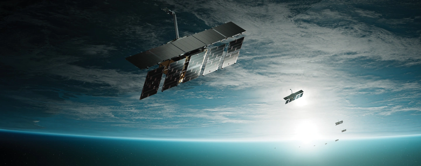
Poland has also recently acquired its own satellite reconnaissance capabilities. On 15 May 2026, the system procured under the MikroSAR programme was officially handed over in an operationally ready configuration. The constellation, comprising four ICEYE satellites, is called POLSARIS (Polish SAR Imaging System)
As technology advanced in the collection and transmission of data, mainly through the widespread adoption of digital systems, the limitations associated with the time required to acquire and process information gradually diminished. Even so, reconnaissance satellites remained relatively few in number. Organizational limitations also persisted because the institutions responsible for satellite reconnaissance remained positioned high within the state hierarchy. This was clearly confirmed during the 1991 Gulf War, when the performance of the US central intelligence organizations responsible for reconnaissance was criticized by commanders. These views were summarized by Gen. Robert Scales, head of the team responsible for preparing the official history of the conflict, who concluded that products prepared at the national level were not always suitable for tactical planning and that, although strategic intelligence could provide tactical-level information, doing so was not its primary mission. As a result, the reconnaissance requirements of commanders below corps level remained unmet.
The minisatellite revolution
The revolution in satellite miniaturization that began around the turn of the 20th and 21st centuries had, resulted in numerous minisatellite designs with masses of 100–500 kg and microsatellites weighing 10–100 kg by the 2010–2020 decade. These included platforms intended for imagery reconnaissance, both photographic satellites and spacecraft equipped with Synthetic Aperture Radar. One of the pioneers, and now one of the leaders in the SAR satellite market, is the European company ICEYE, which placed 76 satellites of its own design into orbit between January 2018 and August 2026. The growing number of such spacecraft in orbit has significantly increased the volume of imagery reaching Earth and, in particular, has made it possible to substantially increase the frequency with which the same area can be imaged, or revisited. ICEYE states that achieving revisit times of around 20–30 minutes requires a constellation of several dozen to roughly 100 satellites in orbit. Doubling that number can reduce the revisit time further, to around 15–20 minutes.
Of course, very few countries are likely to operate constellations of 100–200 satellites. In Europe, national fleets currently usually consist of only a handful of SAR satellites, although the number of systems being acquired in this class is growing rapidly. Until recently, this capability was held almost exclusively by Germany, with seven SAR-Lupe and SARah satellites remaining in orbit, Spain, with the PAZ satellite in service since 2018, and Italy, with five operational COSMO-SkyMed satellites of two generations linked to the French optical component under the bilateral ORFEO agreement. This situation began to change rapidly two years ago, when Greece ordered two ICEYE satellites in September 2024 under a civilian national program conducted jointly with ESA, in which the satellites are operated in orbit by ICEYE. Further orders followed. In February 2025, the Netherlands ordered four Generation 3.5 ICEYE satellites with 25 cm resolution; the agreement was announced publicly in June 2025, when the first Dutch satellite was already being launched into orbit. In May 2025, Poland acquired three satellites, with options for three more, while Portugal ordered a total of four units under three agreements signed in 2025–2026. Northern European countries also joined this group: in September 2025, Finland ordered three satellites under an agreement signed on September 8 worth approximately 158 million EUR net, while in January 2026 Sweden purchased an undisclosed number, with the combined SAR and optical satellite fleet expected to total 10 spacecraft.
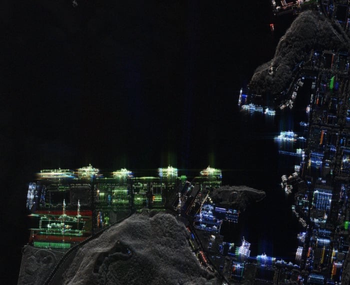
POLSARIS is operated by the Geospatial Reconnaissance and Satellite Services Agency, which is subordinate to the Polish Ministry of National Defence. This means that the satellite imagery obtained will most likely be used primarily to support the production of strategic intelligence
Germany adopted a somewhat different approach. On December 18, 2025, it signed an agreement with the Rheinmetall ICEYE Space Solutions joint venture. Worth 1.7 billion EUR gross, and potentially exceeding 2.7 billion EUR if options are exercised, the agreement does not provide for the delivery of an entire system to the German Armed Forces. Instead, it covers the daily provision of satellite imagery to the Bundeswehr using a dedicated, independent constellation through the end of 2030, with an option for extension. To fulfill these requirements, Rheinmetall ICEYE Space Solutions is expected to place approximately 40 satellites into orbit within 24 months. It is worth emphasizing that the constellation will remain the property of the joint venture, while the program itself, designated by the Bundeswehr as SPOCK 1 (SAR-Spacesystem for Persistent Operational traCKing) is explicitly aimed at the tactical and operational levels. Its primary task is to provide early detection of enemy mobilization and force concentrations on NATO’s eastern flank, with particular emphasis on supporting the 45th Armored Brigade stationed in Lithuania.
Polish satellite reconnaissance capabilities
As mentioned above, Poland has also recently acquired its own satellite reconnaissance capabilities. The contract under the MikroSAR program for the delivery of three radar satellites, with options for three more, together with a mobile ground segment, was signed with a consortium of ICEYE Polska and Wojskowe Zakłady Łączności No. 1 S.A. just over a year ago, on May 14, 2025.
The first Polish ICEYE satellite was placed into orbit only six months after the contract was signed, on November 28, 2025. Two more were launched on March 30, 2026, while the most recent one so far, and at the same time the first of the optional units, joined the original three a month later, on May 3, 2026.
Almost exactly one year after the contract was signed, on May 15, 2026, the completed system was officially handed over to the Polish Armed Forces. The ICEYE satellite constellation was given the name POLSARIS, selected in a competition and derived from Polish SAR Intelligence System.
POLSARIS is operated by the Geospatial Reconnaissance and Satellite Services Agency (ARGUS). It is a new organization within the Polish military, established on June 28, 2024 through the merger of the Geospatial Reconnaissance Directorate and the Military Geographic Center, and directly subordinated to the Secretary of State at the Polish Ministry of National Defence. Within ARGUS, the Satellite Operations Center was established in Warsaw on March 4, 2026, when it achieved operational readiness. The Center serves as a command element in the space domain and is also responsible for coordinating the use of data, services and products obtained from satellite systems. In practice, data received from both national and allied satellites are not only collected there, but also analyzed, verified and ultimately used to support the decision-making process.
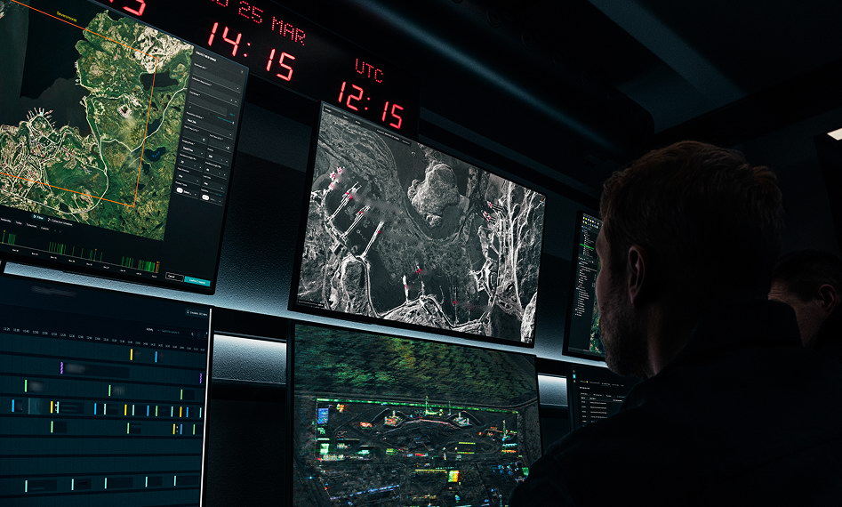
The growing number of reconnaissance satellite constellations available to NATO countries makes it possible to consider the use of satellite reconnaissance not only at the strategic level, but also at the operational and tactical levels
The placement of the Satellite Operations Center within ARGUS, which is subordinated to the Polish Ministry of National Defence, suggests that Poland may face a situation similar to the one described earlier in relation to the United States, in which satellite-derived materials are used primarily to generate strategic-level intelligence, while the provision of information at the operational or tactical level remains a secondary priority.
Use of satellite reconnaissance at the tactical level
How many satellites are needed?
A separate issue is the ability to ensure a high update frequency for information from the same area. Only by combining rapid data acquisition with frequent updates can a significant effect be achieved at the tactical level. This would enable quasi-continuous monitoring of the situation at the front, for example by tracking changes in the enemy’s immediate rear area and thereby allowing troop movements to be detected sufficiently early.
However, as mentioned earlier, obtaining new imagery every 20–30 minutes requires large constellations ranging from several dozen to around 100 satellites. As can be seen, the constellations currently being built are still relatively small, with the notable exception of the one being developed for the German military. It is known that many countries are considering increasing the size of their satellite fleets, even to more than a dozen spacecraft, but this would still not be sufficient to ensure revisit times of around 30 minutes. This does not mean, however, that achieving such a capability necessarily requires expanding one’s own constellation to the aforementioned 100 satellites.
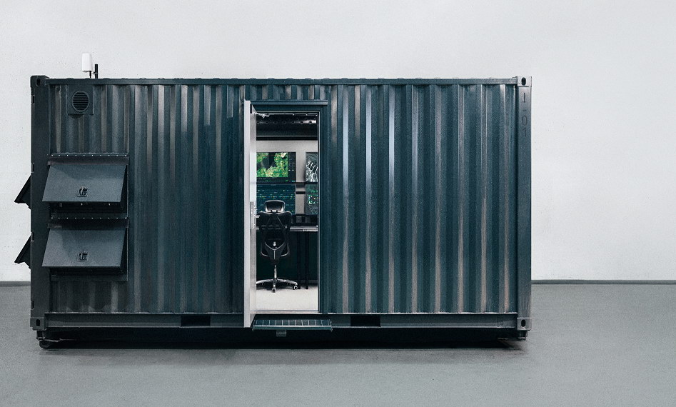
Recognizing the potential for such applications of its satellites, ICEYE developed the containerized, mobile ISR Cell satellite operations center last year. It enables access at every level of command to satellite tasking, data reception, imagery analysis, and the subsequent dissemination of processed intelligence. The center has already been tested during several recent NATO exercises
Recognizing that purchasing such a large number of satellites individually is unrealistic for most users, ICEYE has proposed increasing the amount of imagery available by drawing on other sources. One of these is the company’s own commercial constellation. Some customers purchasing satellites already also buy access to additional data. In response to this demand, ICEYE introduced a subscription service called Tactical Access in October last year. It is intended for regular customers requiring short tasking lead times, high planning flexibility and rapid data delivery. The service enables subscribers to reserve imaging capacity, ensuring immediate availability when required. Tactical Access also offers the option of purchasing a dedicated ground station consisting of an antenna and the ICEYE Edge imagery-processing unit. This allows users to receive satellite data directly and obtain processed imagery within minutes of receiving the raw data, compared with several hours when relying on ICEYE’s own infrastructure as an intermediary.
A second proposal is the shared use of satellites by allies within a so-called federation (ICEYE federation – how can the effectiveness of national satellite constellations be increased), which would likewise make it possible to obtain more reconnaissance material than by relying solely on national assets. The first step in this direction has already been taken: in December 2025, the Finnish Ministry of Defence signed a letter of intent with Poland and the Netherlands on cooperation in the use of SAR satellites purchased from ICEYE. There is undoubtedly still considerable organizational potential that could be exploited to make more effective use of the assets already available. According to currently available, though not fully confirmed, information, European NATO countries already have at least 11 ICEYE satellites at their disposal: four Polish, three Portuguese, two Greek and two Dutch. By the end of 2027, this number should exceed 60. If ICEYE’s own commercial constellation is included, the total approaches the level required to achieve revisit times of 20–30 minutes.
Twenty-five satellites were planned for launch this year, of which 14 had been placed into orbit by the end of August, while in 2027 that number is expected to rise to 40. Current production significantly exceeds the number of launches already contracted: production of 50 satellites was planned for 2026, while manufacturing capacity is expected to double by the end of the year, enabling the production of 100 satellites in 2027.
As can be seen, the technical potential already exists to bring satellite reconnaissance down to the tactical level. The key issue now is the implementation of appropriate organizational solutions within the armed forces.
